[ Article ]
Unlocking CO2 Reduction in Transport with Geospatial Technology
Written by Kurt Janssen
10 September 2023
Share this post
From Greta Thunberg to Just Stop Oil to Governments, it is no secret that there’s pressure from every angle on Corporations to cut down on their CO2 emissions. But how can geospatial technology help?
The EU has stated that from 2035 onwards, the EU fleet-wide CO2 emissions target is a 100% reduction, meaning 0g CO2/km. These targets are just as high in New Zealand, where the Government’s Emissions Reduction Plan (ERP) is targeting a 41% reduction in transport emissions by the same year. It is therefore important for companies, as well as local governments, to better understand their emissions, especially when it comes to transport and logistics.
So where does geospatial technology fit into all of this?
Well, let’s take a look at Orbica’s work in Oceania with Bay of Plenty Regional Council in New Zealand, and City of Casey in Australia.
Bay of Plenty Regional Council were needing to understand the movement of people and freight in the region in order to successfully plan for infrastructure developments and urban maintenance projects. The City of Casey were needing to better understand the current public transport routes around the city, key locations that people want to get to regularly, and urban population, in order to get funding to meet the Victoria State Government’s 20-minute City plan.
In both instances, data was pulled from various sensors placed around the regions and on vehicles. (Now this is where the geospatial, AI and cloud magic happens). By importing this mega data in the Orbica Geospatial Platform, and overlaying the various datasets, it is possible to create a map featuring live movement of both traffic and people, as well as key objects (e.g., pipework, rivers, buildings etc.). Not only is this a great way for the data analysts to do their data analysing, but the visual representation of this data in a live map helped both parties communicate the data they were seeing to other people with whom it impacted.
In the transport field, companies are already starting to use sensors and open-source data to track the CO2 emissions of their vehicles, especially long haul. While we’re seeing this become increasingly more common in the EU, Oceania organisations are starting to pick up on this as well.
But how can you take this data and utilise it even further?
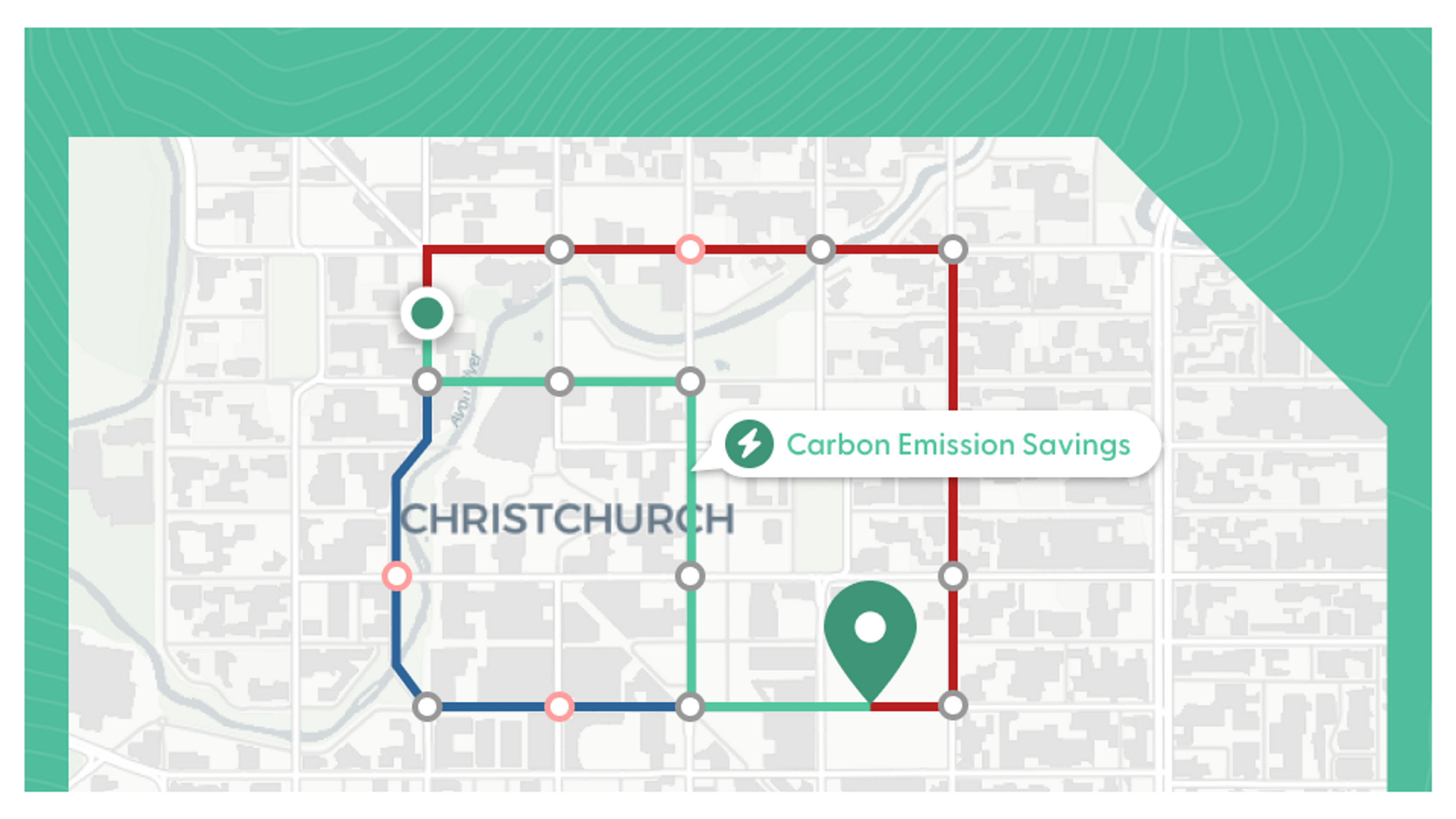
Well, how about creating an incentive for your drivers to take more eco-friendly routes? You could use the same data you are already collecting on your logistic vehicles, number each of them, and overlay their routes with other available routes. You would then be able to do some clever data work and API magic to identify if there was an alternative, more CO2 friendly route that vehicle could have taken. By allocating points to the vehicles which save the most emissions over the year, you now have yourself a lovely incentive for your fleet to help you cut down on emissions.
And if you want proof that this works as an incentive- look no further than Strava. Although not a logistics company, their new feature allows people to track their run, bike or walk commute and in return they are told how much CO2 they saved. And yes, you best believe there will be a Strava Challenge about this.
All sound like rather a lot of work? Well, it turns out that isn’t the case… (and yes, we know this sounds like a plug, but it’sactually true so please keep reading).
The Orbica Geospatial Platform has been built to democratise geospatial data. What does that mean? Well, it means we have created the first end-to-end Platform that allows any user - novice or expert - to easily ingest their data, create projects and workflows to analyse it, and deploy it. We’ve built it using AWS Cloud computing so all your mega data can be easily stored in one place, and best of all- no user-licenses.
Want to find out more? Click here.